HD postcode district map, Huddersfield
Supplier statuses last checked .
The HD postcode area covers 9 districts and 7,202 live postcodes, from HD1 to HD9. It is centred on Huddersfield and also covers Holmfirth, Brighouse and Meltham.
Districts here average 800 postcodes.
Where the HD districts sit
Where HD sits
It falls across Kirklees, Barnsley and Calderdale.
Water supply across HD
All 9 HD districts are supplied by Yorkshire Water. That makes HD simple in a way many areas are not: one company, one set of rules, one status to check.
No hosepipe ban currently applies anywhere in HD.
The shape of the HD area
HD9 is the largest district with 1,205 postcodes around Holmfirth, and HD7 the smallest with 600. The area divides into 39 postcode sectors.
District by district: HD1 serves Huddersfield, HD2 serves Huddersfield, HD3 serves Huddersfield, HD4 serves Huddersfield, HD5 serves Huddersfield, HD6 serves Brighouse, HD7 serves Meltham, HD8 serves Holmfirth and HD9 serves Holmfirth.
Several districts share a settlement, which is a common source of confusion when a form rejects an address: HD1, HD2, HD3, HD4 and HD5 all point at Huddersfield and HD8 and HD9 all point at Holmfirth.
What borders HD
HD sits next to HX (Halifax) to the north west, WF (Wakefield) to the east, OL (Oldham) to the west, LS (Leeds) to the north east and BD (Bradford) to the north west.
Its neighbours run in 4 different directions, so HD is landlocked by other postcode areas on most sides.
HD districts, settlements and water supply
| District | Principal settlement | Water company | Hosepipe ban status |
|---|---|---|---|
| HD1 | Huddersfield | Yorkshire Water | No restrictions |
| HD2 | Huddersfield | Yorkshire Water | No restrictions |
| HD3 | Huddersfield | Yorkshire Water | No restrictions |
| HD4 | Huddersfield | Yorkshire Water | No restrictions |
| HD5 | Huddersfield | Yorkshire Water | No restrictions |
| HD6 | Brighouse | Yorkshire Water | No restrictions |
| HD7 | Meltham | Yorkshire Water | No restrictions |
| HD8 | Holmfirth | Yorkshire Water | No restrictions |
| HD9 | Holmfirth | Yorkshire Water | No restrictions |
Principal settlement is the town or city each district sits in or nearest to, derived from OS Open Names. It is not the Royal Mail post town, which is licensed data and not published openly. Status is resolved live from each company’s own notice.
Water hardness in HD
Figures are in milligrams per litre as calcium carbonate, the unit UK water companies report in. 9 of 9 districts have a published figure.
| District | Hardness | As published | Supply zone | Published by |
|---|---|---|---|---|
| HD1 | 49.4 mg/l That is very soft on the water industry scale. | 49.4 mg/l as CaCO₃ | E01011107, E01011232, E01011235, E01011239 | Yorkshire Water 2026 edition |
| HD2 | 35.8 mg/l That is very soft on the water industry scale. | 35.8 mg/l as CaCO₃ | E01011039, E01011045, E01011105 | Yorkshire Water 2026 edition |
| HD3 | 49.5 mg/l That is very soft on the water industry scale. | 49.5 mg/l as CaCO₃ | E01011147, E01011206 | Yorkshire Water 2026 edition |
| HD4 | 54.9 mg/l That is very soft on the water industry scale. | 54.9 mg/l as CaCO₃ | E01011085 | Yorkshire Water 2026 edition |
| HD5 | 41.5 mg/l That is very soft on the water industry scale. | 41.5 mg/l as CaCO₃ | E01011012, E01011089, E01011093 | Yorkshire Water 2026 edition |
| HD6 | 40.7 mg/l That is very soft on the water industry scale. | 40.7 mg/l as CaCO₃ | E01010875, E01010880, E01010895, E01010946 | Yorkshire Water 2026 edition |
| HD7 | 52.2 mg/l That is very soft on the water industry scale. | 52.2 mg/l as CaCO₃ | E01011073, E01011077, E01011175, E01011177 | Yorkshire Water 2026 edition |
| HD8 | 65.9–79.7 mg/l varies across this district | 73.7 mg/l as CaCO₃ | E01011114, E01011115, E01011119 | Yorkshire Water 2026 edition |
| HD9 | 57.9 mg/l That is very soft on the water industry scale. | 57.9 mg/l as CaCO₃ | E01011178, E01011180, E01011183, E01011186 +1 more | Yorkshire Water 2026 edition |
Descriptions such as very soft, soft, moderately hard, hard, very hard are the water industry scale: very soft below 75, soft 75–125, moderately hard 125–250, hard 250–375, very hard above 375 mg/l. Your supplier may use a different scale for the same number.
Contains Yorkshire Water drinking water quality data, via Stream, licensed under CC BY 4.0. Edition 2026, published 1 January 2026. Yorkshire Water publishes this as mg/l without naming the species. We read it as calcium carbonate because the determinand is Hardness total and the dataset contains no calcium determinand. Evidence: determinand "Hardness total"; DWI code "HARD T"; no calcium determinand published in the dataset.
Hardness is published per census area, not per postcode, so these figures characterise a district rather than measuring one address. They are a scale and taste matter, not a safety one. Hardness data version wessex-water@2022-2025+yorkshire-water@2026.
Download the HD data
No signup, no email wall. GeoJSON carries the district points, the supplier and the live status, so it can be dropped straight into a map.
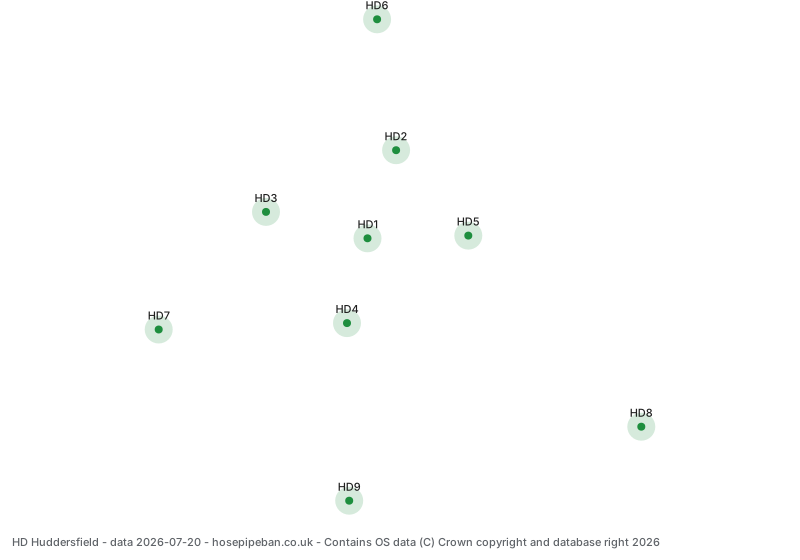
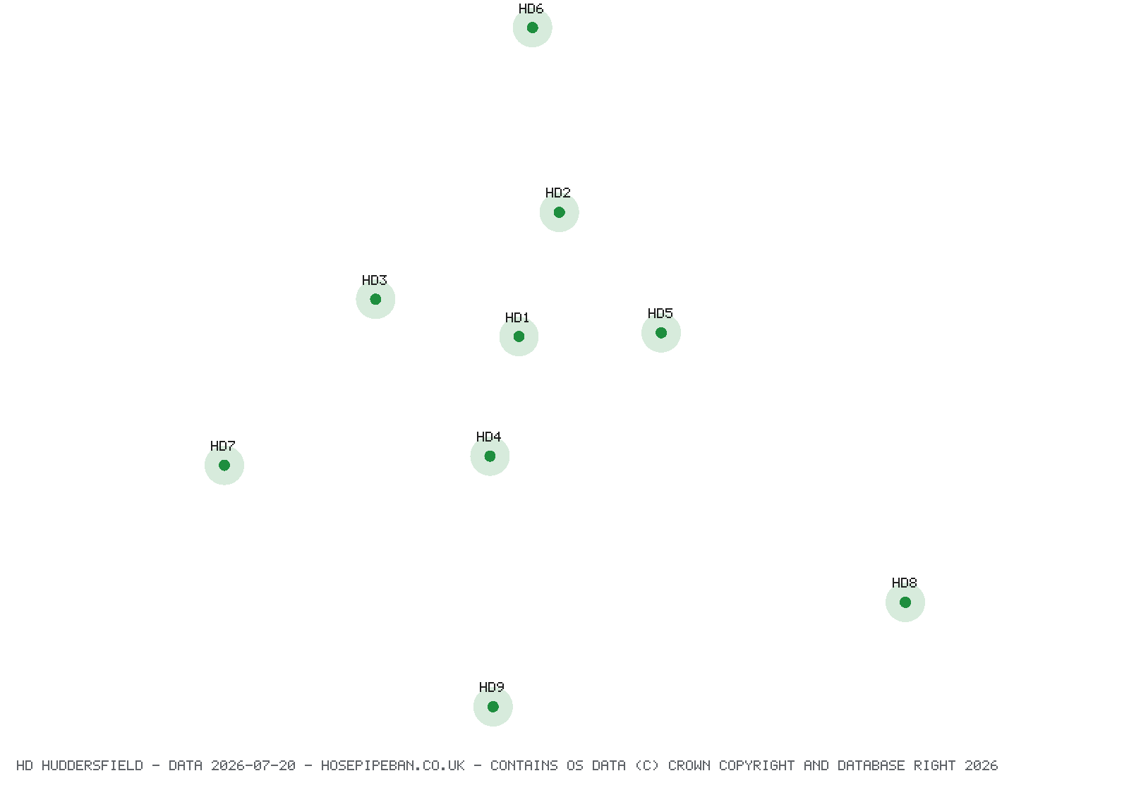
District positions are averaged postcode centroids from OS Code-Point Open. They show roughly where a district sits, not where its boundary runs, and are not legal boundaries.
Frequently asked questions
How many postcode districts are in the HD area?
There are 9 HD postcode districts, running from HD1 to HD9, and they contain 7,202 live postcodes across 39 sectors.
What towns does the HD postcode area cover?
HD covers Huddersfield, Holmfirth, Brighouse and Meltham. The area takes its name from Huddersfield, and each district is listed with its settlement in the table on this page.
Which water company supplies HD postcodes?
Yorkshire Water supplies all 9 HD districts. Supply boundaries follow the pipe network rather than postcode geography, so confirm against your water bill if you are near the edge of the area.
Why do HD1 and HD2 both say Huddersfield?
HD1, HD2, HD3, HD4 and HD5 all serve Huddersfield, covering different parts of it. A single town routinely needs more than one postcode district once it passes a few thousand delivery points, so this is normal rather than an error in an address.
Can I download a free HD postcode map?
Yes. This page offers the HD districts as GeoJSON, CSV and SVG, free and with no signup or email address required. The GeoJSON carries each district's position, its water company and its current restriction status, so it can be dropped straight into a mapping tool.
Why is the HD area called Huddersfield when it covers Holmfirth?
HD takes its letters from Huddersfield, where the sorting office that served the area was based when the code was allocated. Holmfirth is the largest settlement in the area today, in HD9, but the area code follows the historic sorting geography rather than current population.
Which councils cover the HD postcode area?
HD reaches into Kirklees, Barnsley and Calderdale. A postcode area is not a council area: they were drawn for different purposes and a single district can sit across a council boundary, so your postcode does not tell you which authority you pay.